Life On Ice
Last modified: 12th August 2019
Sept. 15 2011 to Nov. 15 2011 - The edge of Malaspina Glacier
Pull a load over the gravel-strewn ice in a packraft-unicycle-cart. Sing the 700th verse of Old MacDonald to the toddler on my back. Photograph the sunrise on the towering peak of Mt. St. Elias. Nurse the baby in the driving rain. Upload all of it to Facebook…
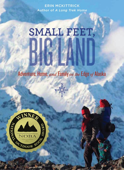
Read about it in Small Feet, Big Land: Adventure, Home, and Family on the Edge of Alaska - October 2013
- (Looking for Life on Ice by Lonnie Dupre?)
- Essays and Articles
- Maps
- Pre-Trip Route Proposal
- Slideshows
- Favorites
- Ice
- Gear photos (multiple trips)
- Expedition Prep
- Malaspina Glacier
- Adventures in a Warming Alaska
- Media Links
- Related Journeys
- Our first journey to Malaspina Glacier
- Chukchi Sea at Toddler Speed
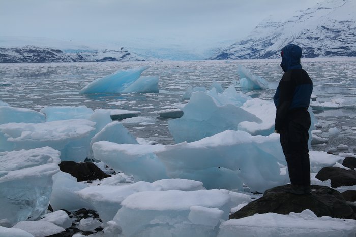
What is it like to live on ice? In the fall of 2011 we set out to spend two months living on the shifting, melting surface of North America’s largest glacier, along with our two young children.
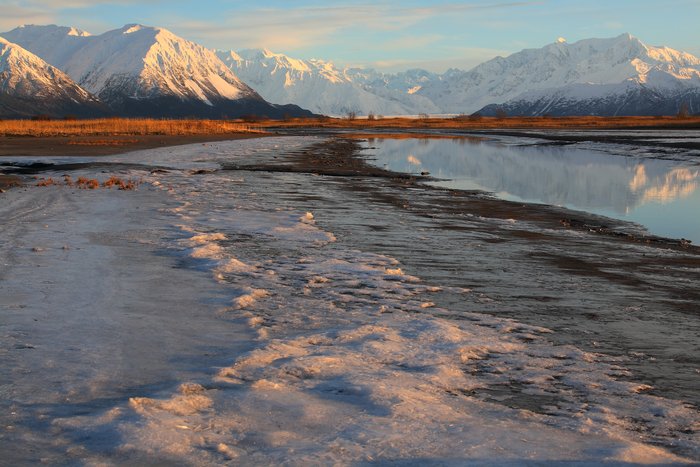
Trekking over 100 miles between a series of camps on the Malaspina Glacier, we traveled from the ice-locked Samovar Hills, across the vast lobe of the glacier, and around its melting coastal edge. Along the way, we weathered the fall storms of Alaska’s remote and harsh Lost Coast, lugged 50 pounds of kids across rubble fields, ice, and beaches, and explored climate change in action. From dramatic coastal erosion to newborn lakes and disappearing rivers, this 1000 square mile glacier is the most dynamic place we’ve ever seen.
The Vision:
Climate change is all around us, but often difficult to see. On the computer, we can look at maps and temperature graphs, read studies on species shifts, and look up numbers on shrinking ice… But on the edge of Malaspina, we could see and feel climate change - reshaping rivers, beaches, forests, and the ground we walked on.
Malaspina lies on a remote stretch of coast between Southeast Alaska and Prince William Sound. It’s the largest lowland glacier in North America, and quickly melting away with the rest of them. This area changes so fast that the maps made decades ago are nearly useless. It changes so fast that even our memories from our 2007 journey through parts of the region don’t match reality. Tromping on forest-covered ice, past cold springs, over moraines, and along an eroding coast, this journey showed us visceral picture of the rapid climate change we often overlook - in a place so dramatic we couldn’t possibly overlook it.
The Challenge:
Two months without a chance to step inside a building, through the cold wet fall storms on the Gulf of Alaska.
Over 45lbs of children to carry, along with a packraft, a woodstove, a bear fence, and enough clothing, gear and diapers to keep the whole family comfortable.
The technology to take photos and movies of the melting glacier, make satellite updates from the field, and charge batteries without a stop in town.
The Logistics: Pre-trip Worries and Wonderings
On our year-long trek from Seattle to the Aleutians, we pushed the limits of lightweight wilderness travel in harsh conditions. On our month long trek along the Chukchi Sea, we explored the edges of what was practical to do with a toddler. Now how do we combine them?
Being on Malaspina Glacier in the fall is one of the most amazing experiences we’ve ever had - marked by some of the most difficult weather we’ve been in. And this time we have two young children too small to carry their own weight.
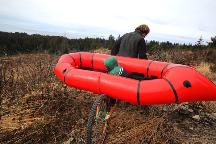
To allow a more in-depth exploration (and to make a trip with two babies even remotely possible), we’re doing this trip base camp style. Titanium Goat is sponsoring us an awesome-looking tent that we’ll be able to heat up and dry out in (around 6 pounds including the woodstove). Given the weather we expect, I suspect this will make the difference between a great adventure and some unhappy babies. Alpacka Raft has given us an extra long packraft that we can cram all four of us into. Because we’ll be camping in one place for an extended chunk of time, we’ll bring a small electric fence for bears. Because we’ll want to do lots of photography and make updates from the field, we’ll have a bunch of electronics with us. Because we won’t be anywhere near a town the entire time, we’ll need to recharge batteries in the field, and set up a series of food caches before we start.
We plan to be human-powered for the whole two months. About six weeks of the journey will be in a series of three different base camps, taking day trips and short overnights between them. The other two weeks will be somehow figuring out how to move between them. Hiking around Seldovia wearing two kids on our backs makes it pretty clear we won’t be able to carry all the stuff in any straightforward fasion. Plan A is being concocted by Hig right now, and may involve a bizarre packraft unicyle rickshaw cart. Plan B involves ferrying loads back and forth, planning only a few miles per day. Plan C will be invented as we need it.
If it didn’t seem a little bit impossible, it wouldn’t be a good adventure.
The Logistics: How did it work out?
Everyone survived (and even enjoyed the journey). The Titanium Goat tent (and it’s amazing stove) saved our a**. The diapers held out. The rickshaw was an idea perhaps more clever than functional. And solar power is a difficult thing to rely on in a sleeting November.
Sponsors
For this expedition, we were grateful to receive sponsorship from the Mountaineers Foundation, gDiapers, Titanium Goat, Alpacka Raft, Mountain Laurel Design, and generous donors to Ground Truth Trekking.
From our First Visit…
The first time we visited the edge of Malaspina Glacier, we knew it deserved a longer expedition. From my book, A Long Trek Home describing our visit in fall 2007:
The stream began in a spiraling whorl, bubbling up like a fountain from the top of a set of terraced steps, straight from the muddy floor of the young alder forest. The steps were made of ice. Super-cooled water rushed up from a great depth, freezing as it reached the lower pressure of the surface. Which meant that the brushy patch of alder, devils club, and salmonberry we ’d been walking through was a part of the Malaspina Glacier. Hundreds of feet of ice lay beneath us, stretching far below sea level. We’d been walking past, or on, the Malaspina Glacier for days, but camouflaged beneath its blanket of forest and brush, we might never have noticed the ice.
Nearby, a patch of muddy grass opened onto a small lagoon –a third of a mile wide–ringed all around with bluffs of dirty ice. On top of the ice cliff, a young spruce forest waited for its inevitable demise. Trees leaned precariously over the melting bluff. Carpets of forest soil that had once lain on ice hung over the rapidly melting edge, blowing in the wind. A pile of fresh trees lay in the water below, upturned and broken. At high tide, the surf crashed over the boulders and through the narrow opening, sending streaks of sea foam across the bite-sized lagoon.
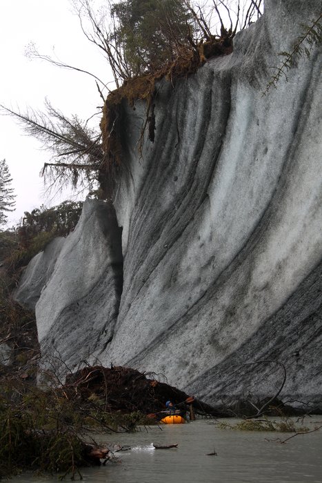
On our thirty-year-old maps, this was the Sitkagi Bluffs. The USGS drew cliffs of ice three hundred feet high, running for miles along the shore. But the ice cliff over the lagoon was barely fifty feet tall, and we hadn ’t seen a hint of a bluff anywhere else. I tried to picture the sheer volume of ice that had melted since the maps were drawn. Hig speculated with a hazard geologist’s glee. Perhaps the relatively warm salt water running into the lagoon could set off a catastrophic melting cascade–turning this 35-mile-wide lobe of ice into a giant ocean bay within only a handful of years.
On the Lost Coast, geology was now. The world was building, crumbling, shifting, and melting before our eyes.
And it wasn ’t just the glaciers that moved. As the lobes of ice retreated, entire rivers disappeared with them. As the powerful storms and currents moved sand along the shore, the mouths of the rivers still remaining shifted miles westward on the coast. As the weight of ice was relieved, the land rose up, sending beaches marching out into what had been the realm of the ocean. In other places, rivers feeding sand to the beach had moved, setting off rapid erosion. Ocean waves curled where forests had stood before.
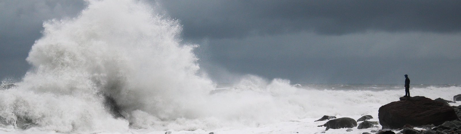
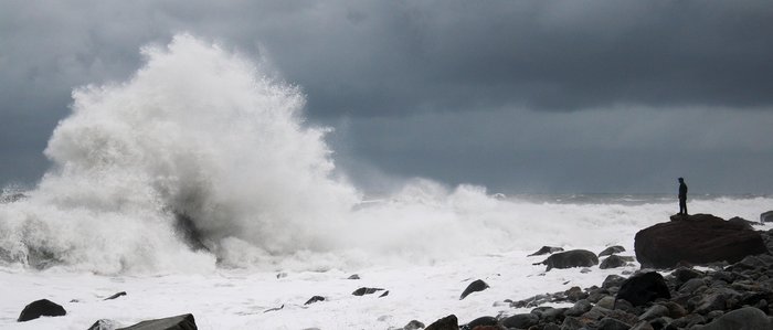
It ’s hard to describe the Lost Coast in anything but extremes. Giant peaks of the St. Elias Range rise almost straight from the ocean, creating some of the highest relief in the world. Flowing down from their snowy ice fields, North America’s largest glaciers spill onto the beach plain in huge, rapidly melting lobes. Storms whipped up in the Aleutians whirl down the coastline, funneled onto the narrow strip of beaches between the roiling ocean and the towering peaks.
The Place:
Malaspina Glacier is rapidly melting, like many glaciers. But at 1000 square miles of lowland ice, the sheer scale of Malaspina provided a uniquely dramatic setting to explore and live in the midst of rapid climate change. The lower edge of Malaspina bears little resemblance to the stereotypical glacial landscape of jagged crevasses on barren white ice that is commonly crossed by explorers. But as climate change accelerates, the glacial margins are the most rapidly and dramatically changing areas, and some of the most important.
You might say that our family was born on the Lost Coast. During a harrowing (and failed) attempt to cross Icy Bay, just beyond the edge of Malaspina Glacier, we made the decision to have our first child. Now a toddler, Katmai joined us on this adventure, along with his younger sister Lituya. In over 7000 miles of country, the Lost Coast stays with us as a place that seems to embody the very definition of wilderness. A place not set up for humans, and outside of human rules. The intensity of the Lost Coast was like nothing we’d ever experienced. And when it was gorgeous, it was the most gorgeous place on earth.
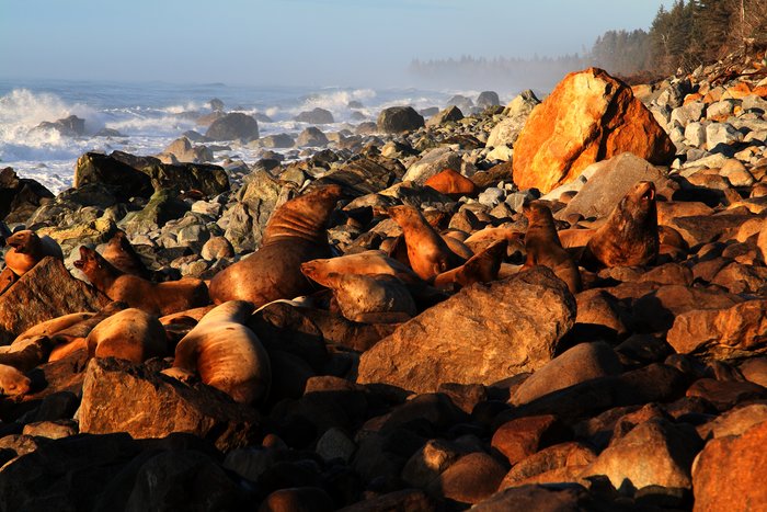
The fall months bring some of the most dramatic weather of the year to this harsh place. Torrential rains and driving wind storms alternate with days of beautiful low-angle light that turns the icy peaks pink and makes the surf glow orange. Travel in this region is rare to begin with - with almost no one coming in the storms.
This journey was about depth, rather than breadth. Kids slow us down. The toddler’s eye view forced us to explore things in detail, making discoveries we missed altogether when we blew by this area in a couple days. At an explorer’s pace (rather than an athlete’s) we were able to wander back from the easiest path, looking for clues to what lies in store for a melting Malaspina.
Along the way, several guests came to join us for pieces of the journey, weathering the storms along with us, taking toddler tantrums in stride as they huddled with us in our heated tent, and seeing at least a piece of what makes Malaspina amazing.
Created: Jan. 19, 2018