From Glaciers to the Sea: Following the Entirety of Alaska’s Susitna River
Last modified: 13th February 2020
See here for a newer PDF version of this journey writeup.
Start date: September 2012
End date: September 2013
Distance: around 400 miles
Mode of travel: packrafting and walking
- Journey Overview
- Journey Writeups
- Slideshow
- Susitna Hydro
(Article by Chris Dunn)
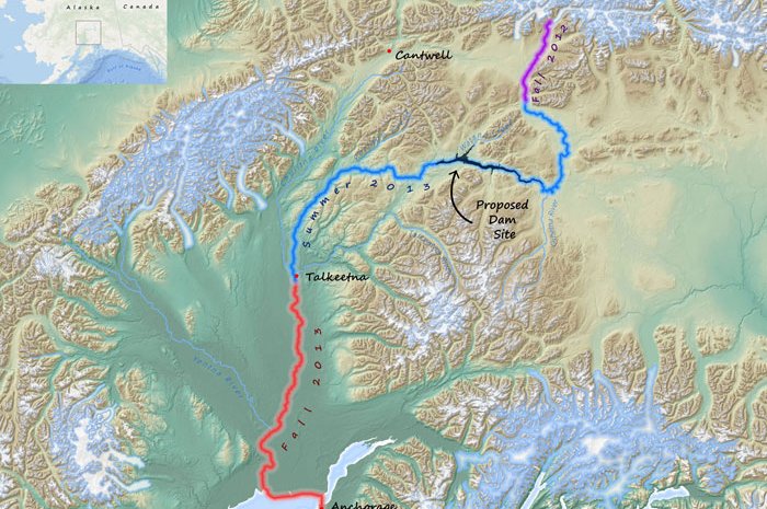
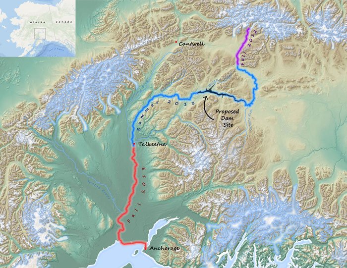
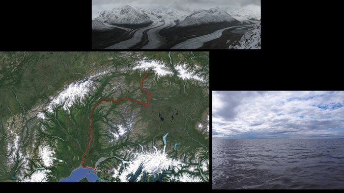
In September 2012 I began a float on the Susitna River that would ultimately take me down its entire 310 mile length, though broken up into 3 legs over the course of a year. The river makes an amazing journey that begins high on the glaciated flanks of the Alaska Range traveling through bare rock and ice to expansive treeless tundra to dense boreal forest through several significant canyons and ultimately ends in the Gulf of Alaska via Cook Inlet.
I made this journey because a project to dam the Susitna River currently has Alaska state backing with significant studies funded and taking place. With the possibility of such a large wild river being altered for the rest of my lifetime and beyond I wanted to witness firsthand what might be lost. Though the dam and reservoir will exist only on a small portion of the river, the effects will extend well beyond, if only in destroying the continuity of a wild river.
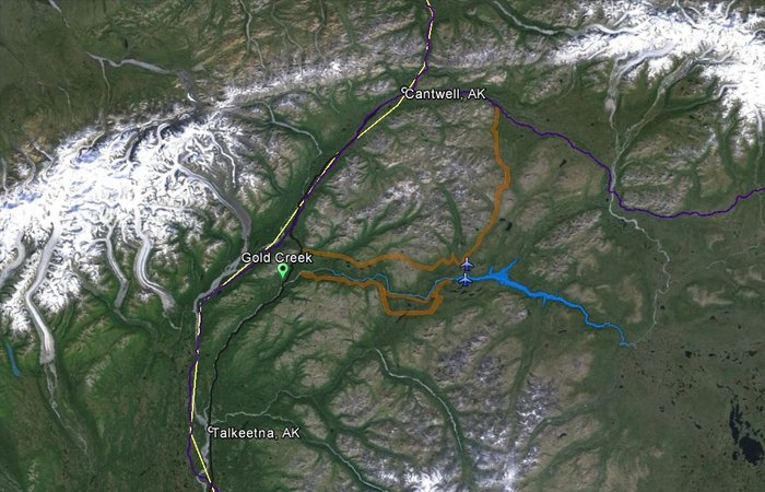
DAMSITE MAP
 — 
<a class="figure-caption__link" href="/photos/damsite-map/">Get Photo</a></figcaption></figure>Alaska is planning to build the Susitna Dam in order to meet its goal of obtaining 50% of its energy from renewable sourcesby 2025. This is certainly a worthy goal - presumably cutting greenhouse gas emissions and moving the state closer to sustainability. However, some significant questions need to be asked. Is the Susitna Dam the best way to achieve this? Will it meet Alaska’s energy goals? Is the dam logistically feasible? Is it in fact renewable? And above all, is the sacrifice of such a large, intact span of wild country and river necessary and worthwhile?
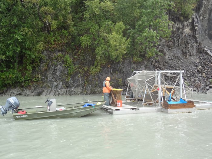
FISH TAGGING ON THE SUSITNA RIVER AT CURRY
 — 
<a class="figure-caption__link" href="/photos/fish-tagging-on-the-susitna-river-at-curry/">Get Photo</a></figcaption></figure>More than any other state and more than most other land regions on earth, Alaska is a land of what might be called wilderness - of the untamed and undeveloped. As of now, none of Alaska’s major rivers are dammed. The Susitna River currently runs entirely unimpeded, with only two road crossings and one rail crossing. It is exceptional for a river of this size and volume to be undammed anywhere on the planet. A dam on the Susitna would certainly affect the wilderness quality of a large portion of Alaska by way of the reservoir, the dam itself, airstrips, transmission lines, and the anticipated new road accesses to the area. Smaller-scale dams are common across Alaska, and power most of the Southeastern portion of the state, but a project on the scale of the Susitna Dam would be unprecedented.
On the one hand, a development like the Susitna dam will blot out one more piece of the wilderness that makes Alaska unique. On the other hand, Alaska’s energy comes overwhelmingly from fossil fuels. Burning these fuels is the primary contributor to the warming of the planet, and is warming Alaska even faster. Glaciers, including the Susitna Glacier, are melting and retreating across the state. One way or another, Alaska’s wild places are changing. The Susitna Dam might provide an alternative energy source to fossil fuels.
Yet the Susitna Dam is only one of many large scale developments under serious consideration in the state. All across Alaska, proposals are in the works to dig into the vast wealth of minerals beneath its soil - from coal to copper to gold - proposals that require not just roads and pipelines, but also vast amounts of energy. In a state large on area and short on infrastructure, that energy is hard to come by. A dam on the Susitna may provide energy not just for Alaska’s homes and stores, but for its future open pit mines. Alaska is thus at a major crossroads. How much of its wild identity will be traded away to unleash its vast wealth?
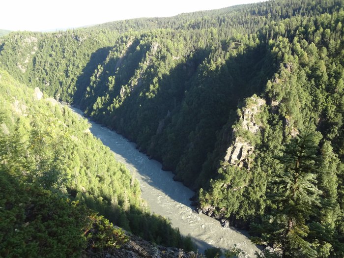
DEVIL'S CANYON, SUSITNA RIVER
 — 
<a class="figure-caption__link" href="/photos/devils-canyon-susitna-river/">Get Photo</a></figcaption></figure>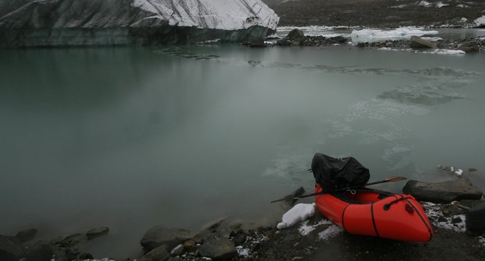
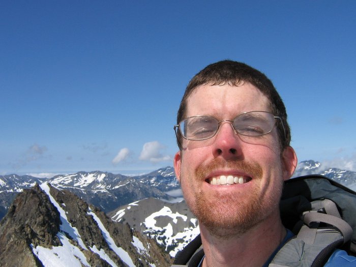
CHRIS DUNN
 — 
<a class="figure-caption__link" href="/photos/chris-dunn/">Get Photo</a></figcaption></figure>Who?
My name is Chris Dunn. This was one of the biggest trips I’d yet tackled in terms of logistics and challenges. During the summer of 2008 I had the privilege of solo hiking approximately 500 miles in the Canadian Rockies. I also have been fortunate enough to have worked and played in the wilds of Alaska, Montana, and Washington, and to have traveled much of the world witnessing firsthand its incredible vastness, diversity, and rapid changes. I currently work seasonally in Alaska.
Continue to Leg1: Headwaters
See Chris’s new website, and the other adventures he’s doing: Chris Dunn on Planet Earth
Created: Jan. 19, 2018