Fig. 4: Iliamna Terrace Data
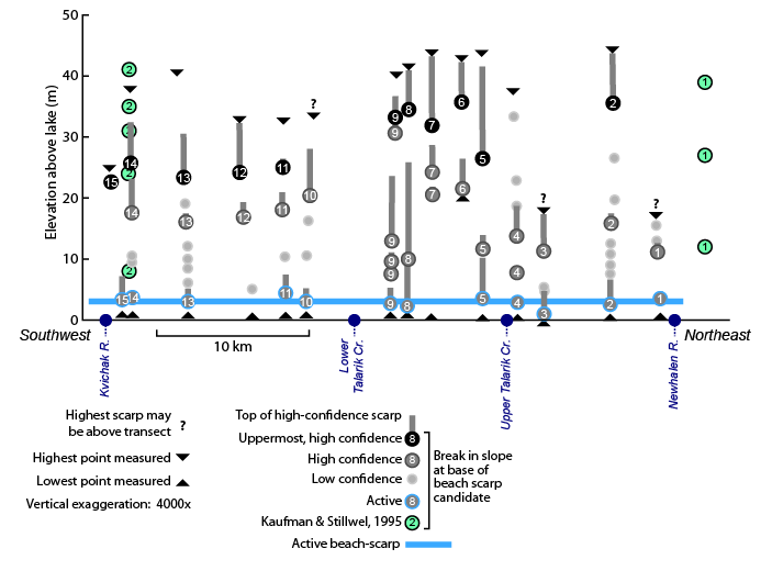
For each transect we measured across the Iliamna terraces, we noted locations that might mark paleo-beach-tops. Survey points taken at the break in slope below steeper lake-facing slopes were then projected onto a plane running roughly southwest along the lake shore Our transect data and the projection plane used here are shown on Map 5. For clear scarps, the height of the slope above these points was noted as a vertical gray bar.
Ideally, these beach-top candidates are the location of distinct erosional scarps, creating a break in slope that would commonly be surveyed as a measure of paleo-water level. However, in many cases breaks in slope were of uncertain origin. To depict this uncertainty, the base of steep slopes that were clear candidates for erosional scarps (e.g. near-angle of repose, or cross-cutting higher beach-ridges) were marked as "high confidence." More subtle features that could mark either important beach-tops or instead mark glacial topography that preceded lake formation were marked "low confidence." Low confidence breaks in slope were not considered in our interpretations.